Point Cloud
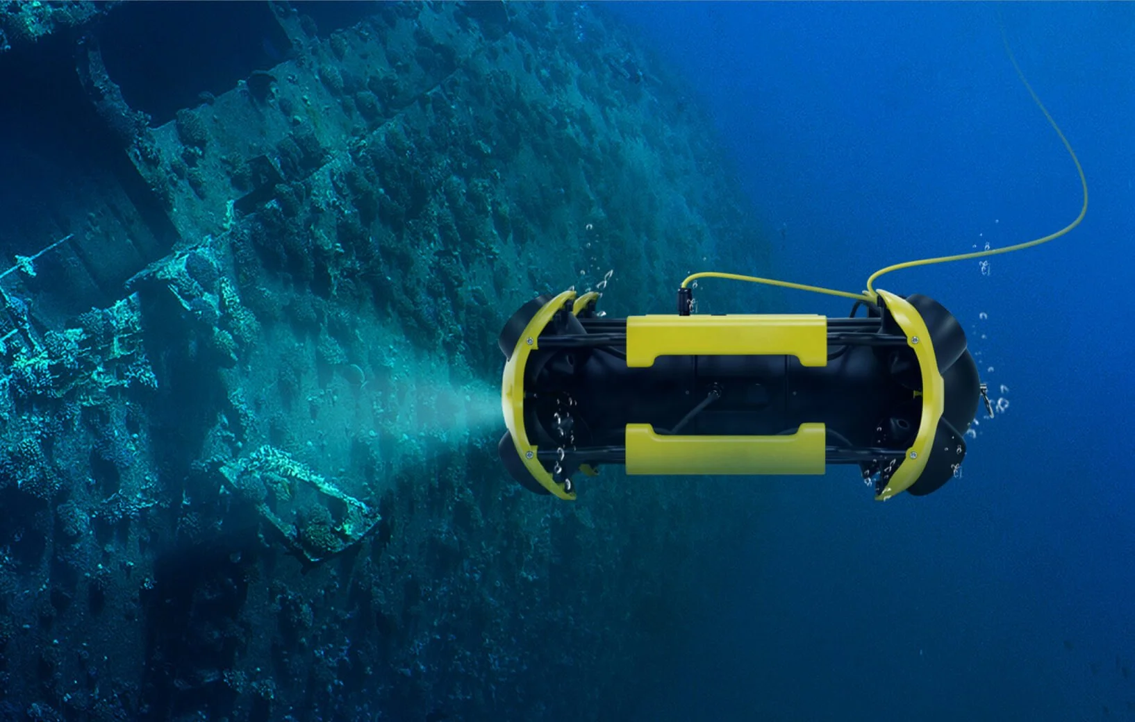
Submersible ROV surveys provide a safe and efficient way to capture underwater survey data without the need for diver entry. Using remotely operated vehicles, we deliver high-quality visual information to support asset assessment, maintenance planning, and long-term management of submerged and confined environments.
Unlock the Power of Aerial Insights for Your Construction Projects!
Are you looking for a cutting-edge solution to monitor and track the progress of your construction sites? Team UAV is proud to offer our comprehensive Construction Site Drone Progress Monitoring Service. Harnessing the potential of drones, we provide you with real-time, accurate, and actionable data to streamline your construction processes and ensure project success.
Our world is rapidly changing to be more digital, the data we view isn’t numbers and letters anymore it’s images, videos and high-resolution 3D models. Everyone is consuming more and more data every year.
As technology advances, the number of megapixels in our sensors also increases, but so too does the size of the datasets that we capture. As a technology business, we have to have the best systems available to be able to view our raw datasets at high speed, but that isn’t always the case for our clients. They may use older computer systems or systems that aren’t as fast. But they still need to be able to view the data – even more so than we do!
We don’t just hand over thousands of images or videos, we give you an intuitive platform to view and analyse your data, saving you hours of review time.
World Leading Drone Inspection Services with Software to Match.
Team UAV’s expert Drone Pilots together with our state-of-the-art equipment and industry-leading software, allows us to deliver uncompromising close visual inspection images and video. Long gone are the days of handing over thousands of images on paper… We deliver your data on our inspection software that allows you to quickly analyse, share and create reports at the touch of a button.
When you first make contact with us, a member of the team will talk through your project with you or meet you on-site if you prefer. Once we have all the details and everyone’s happy, we’ll schedule a date for one of our experienced Drone Pilots to carry out the work. From there, we’ll process your data and give you access to our drone survey software that makes viewing orthomosaics easy, navigating complex point clouds or 3D models a breeze, and taking 2D and 3D measurements a pleasure. Our interactive software allows you to visualise, measure, interact, export and share your data easily and securely. Our data also easily integrates with your existing GIS or CAD software too, by simply exporting your required file type.
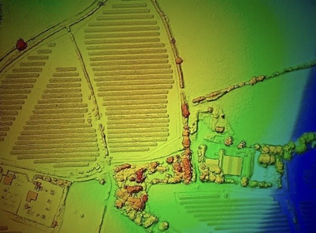
Over the past 9 years, we have built in-house expertise in Digital Twin modelling and point cloud generation. Working with our UK and international client base, We have captured data on over 100’000 assets and turned them into ultra-high-resolution dense point clouds and digital twin models. Using state-of-the-art and specialist RTK ground control points and RTK-enabled drones, our data is accurate to millimetres.
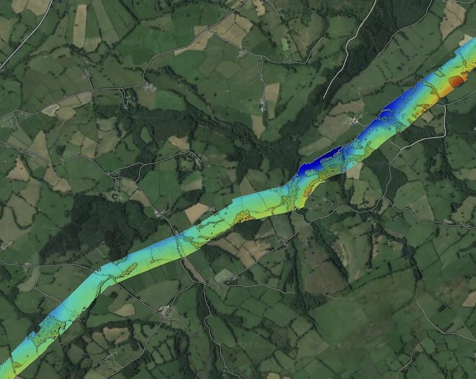
Our teams specialise in long corridor surveys. Over the past decade, we have developed a method that allows us to cover over 50km per day. We can work to your exact specification or if you’re unsure of the specification, we can work with you to develop it. We can carry out
Video surveys, Topographical surveys, Multispectral surveys of rail, power lines, pipelines, proposed routes, in-progress routes, thermal surveys, leak detection surveys, environmental surveys, flood defence surveys etc.
With a decade of experience in precision photogrammetry work for Government Agencies, MoD, National Infrastructure and private clients, we can capture highly accurate digital surface models using our range of fixed-wing or multirotor drones.
A single drone team can capture vast parcels of land per day, or carry out long corridor flights, and we can usually turn the data round for you within 24 hours. We can work on the coast, up a mountain, in rural and urban areas. On construction sites and aboard ships if needed. Our teams are used to working in demanding environments.
At the forefront of technological innovation, our Drone LiDAR surveys leverage a state-of-the-art LiDAR module, an exceptionally accurate Inertial Measurement Unit (IMU), and a 1-inch CMOS camera seamlessly integrated into a 3-axis stabilised gimbal— all mounted on our advanced drone platform. This sophisticated setup empowers us to capture expansive areas, covering up to 2 square kilometres in a single flight. The capability to gather data around intricate structures from an aerial perspective allows us to deliver meticulously accurate reconstructed models and generate real-time true-colour point cloud models.
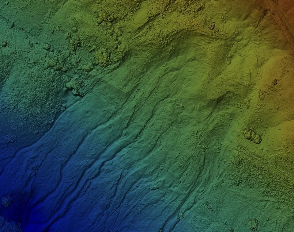
Drawing upon a decade of expertise in precision photogrammetry, Team UAV excels in producing highly accurate Digital Surface Models (DSMs) and Digital Terrain Models (DTMs) for Government Agencies, the Ministry of Defence (MoD), National Infrastructure, and private clients. Utilising our fleet of fixed-wing and multirotor drones, a single drone team can efficiently capture expansive land parcels or conduct extensive corridor flights. Remarkably, we prioritise delivering results promptly, with data turnaround typically within 24 hours.
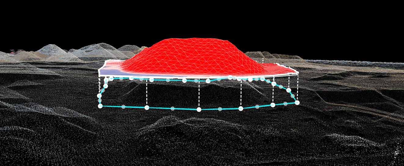
A Stockpile & Volumetric Drone Survey involves using drones equipped with advanced sensors and technology to assess and calculate the volume of materials stockpiled in a specific area. This survey is particularly useful in industries such as construction, mining, agriculture, and logistics, where accurate measurements of stockpile volumes are crucial for operational planning, resource management, and inventory control.
Over the past 9 years, we have built in-house expertise in Digital Twin modelling and point cloud generation, setting new standards in precision mapping. Employing RTK-enabled drones and specialist ground control points, our data accuracy reaches millimetre precision. Our ability to tackle projects at scale is a testament to our experienced pilots and robust back-end support.
We use the latest RTK and PPK positioning technology onboard our state-of-the-art surveying drones and ground control points to tie in our data in even tighter. Our drone surveys are ultra-accurate, proven down to 25mm in x,y,z – and under 1cm per pixel GSD.
Digital Twin & Point Cloud Data Capture
Our high-resolution cameras take clean, crisp images. We then turn these images into realistic digital twin models using a process known as photogrammetry. This aligns all of the images, stitches them all together, georeferences each individual pixel and then creates a point cloud from the pixels.
Valuable Experience: Team UAV has honed its expertise in Digital Twin modelling and point cloud generation. Working closely with a wide-ranging clientele both in the UK and internationally, we've transformed over 100,000 assets into ultra-high-resolution dense point clouds and digital twin models. Utilising cutting-edge RTK ground control points and RTK-enabled drones, our data boasts millimetre-level accuracy
Scaling Projects with Expertise: Our ability to undertake projects at scale sets us apart. We routinely handle large-scale ventures spanning multiple sites across expansive areas, backed by experienced pilots and comprehensive backend support.
Diverse Point Cloud Projects: Our portfolio includes diverse projects such as modelling holiday parks, national infrastructure wastewater treatment sites, flood defences, bridges, historic buildings, construction sites, demolition sites, solar farms, and large residential and commercial buildings.
Accurate Volumetric Calculations: Our high-accuracy point cloud data enables the creation of digital twin and realistic 3D models of stockpiles. Through precise volumetric calculations, accurate to within 5%, we provide data displayed on a user-friendly interface for easy sharing with stakeholders. We also offer scheduled surveys for regular services, ensuring up-to-date information for accounts teams and site managers.
Versatility in Operations: We operate in diverse environments, from coastal areas to mountainous landscapes, rural and urban settings, construction sites, and even aboard ships. Accustomed to demanding conditions, our teams deliver reliable results wherever the project takes us.