
What is Photogrammetry, and how does it work?
The Evolution of Photogrammetry Technology
Recent advancements in digital photography, software, and drones have revolutionised the field of photogrammetry, enabling high-precision surveys at relatively low costs across various scales. Photogrammetry drones are now widely used in diverse fields such as archaeology, heritage architecture, structural inspections, and emergency surveys.

What is Drone Photogrammetry?
Drone photogrammetry involves using a drone to capture numerous two-dimensional images over a geographic area. These images are then processed using specialised photogrammetry software to create accurate three-dimensional terrain models and orthomosaic maps.
Unlike simple photographs, drone photogrammetry provides multiple perspectives of the same ground point from different angles and altitudes. This data allows for the creation of detailed 3D maps that include useful visual cues such as colour and texture.
Historical Context of Photogrammetry
Photogrammetry has its origins in surveillance and reconnaissance and has been in use for approximately 150 years. During World War I, pilots combined photography with manned flights to gather intelligence from behind enemy lines. Over the decades, this practice evolved with the advent of new tools, ranging from stratospheric U2 aircraft to advanced weather satellites, and now, modern drone photogrammetry. There are typically 3 types of drones that are used for data collection:

How Drone Photogrammetry Works
Drone photogrammetry is a two-stage process involving image capture and image processing:
Image Capture: A drone equipped with a high-resolution camera captures numerous overlapping photos of an area. The key to effective photogrammetry is ensuring that these photos overlap by at least 60-80%, allowing the software to match points between images accurately. This overlap ensures that the same ground points are visible from different angles and elevations, providing multiple perspectives of each point. The resolution of these images, typically measured in megapixels, determines the level of detail that can be captured. Higher resolution cameras, such as those with 20MP or more, can capture finer details, which is crucial for creating accurate 3D models.

Image Processing: The captured aerial photos are then processed using advanced photogrammetry software. This software uses a process called Structure from Motion (SfM) to identify common points in multiple images and reconstruct their positions in 3D space. The software stitches the overlapping images together into a single high-resolution orthomosaic map and 3D model. Several key steps in this process include:
Distortion Correction: The software corrects for lens distortion, ensuring that straight lines in the real world appear straight in the images.
Georeferencing: Using GPS data from the drone, the software accurately places the images in the correct geographic location.
Orthorectification: This process corrects the images for terrain relief, sensor tilt, and perspective distortion, ensuring that the final map is accurate and scale-corrected.

Assigning Coordinates to Pixels
During the image processing stage, each pixel in the captured images is assigned coordinates in three-dimensional space (X, Y, and Z). Here’s how this is accomplished:
Ground Sampling Distance (GSD): GSD is a measure of how much ground each pixel in the image represents. For example, a GSD of 2cm means that each pixel represents a 2cm by 2cm area on the ground. The smaller the GSD, the higher the resolution and accuracy of the resulting map and model. Factors that affect GSD include the camera resolution, the altitude of the drone during flight, and the angle of the camera.
Image Matching and Tie Points: Overlapping pixels from multiple images are matched during processing to triangulate the exact position of features on the ground. This process relies on finding common points, or tie points, across images. Each tie point is used to calculate the precise location of that point in three-dimensional space, effectively giving each pixel a coordinate (X, Y, Z). The more tie points found, the more accurate the 3D reconstruction will be. High overlap (typically 70-80%) ensures that each point on the ground is visible in multiple images, enhancing the reliability of the matching process.
Ground Control Points (GCPs): Ground control points are pre-measured locations on the ground with known coordinates. These points are marked and used as reference points during the photogrammetry process. GCPs are crucial for enhancing the accuracy of the 3D models and maps. By tying the images to these known points, the photogrammetry software can correct any positional errors and ensure that the coordinates assigned to each pixel are highly accurate. This step is particularly important for applications that require survey-grade accuracy.
Camera Calibration and Pixel Accuracy: High-quality cameras used in drone photogrammetry are calibrated to ensure that pixel measurements are as accurate as possible. Calibration accounts for any distortions or aberrations in the camera lens, ensuring that pixel measurements translate accurately to real-world distances. This calibration is essential for achieving high-precision models and maps.
Post-Processing Enhancements: Advanced photogrammetry software includes algorithms that refine pixel data to enhance accuracy. These algorithms adjust for any residual errors, ensuring that the final 3D model or map is both visually accurate and dimensionally precise.
Benefits of Drone Photogrammetry Services
Using drones for photogrammetry offers several advantages over traditional methods:
Improved Efficiency and Accuracy: Drones can quickly and remotely gather detailed information about target areas. They fly lower than manned aircraft and use advanced technology to deliver highly accurate 3D models, often with accuracy up to the centimetre level.

Enhanced Safety: Drones can capture images from remote and potentially dangerous locations, reducing the risk to human surveyors. This capability is particularly useful in areas with severe volcanic activity, crime or war zones, complex terrain, and harsh weather conditions.
Cost-Effective Solution: Drone photogrammetry is more accessible and cost-effective compared to traditional aerial photogrammetry, making it viable for small and medium-sized organisations.
Real-World Applications of Drone Photogrammetry Services
Oil & Gas
In the oil and gas industry, drones are used for pipeline construction, infrastructure maintenance, and remote inspections. They provide 360-degree views of objects, monitor site operations, and help identify damage or leaks, facilitating quicker repairs and minimising local impact.

Mining & Quarries
Drone photogrammetry is used to generate digital surface models, digital terrain models, and 3D models of mining sites. This allows for accurate volume calculations, road construction design, site progress monitoring, and the inspection of hard-to-access areas to prevent accidents and ensure worker safety.

Agriculture
Drone photogrammetry helps in managing large areas of land by capturing images of crops to detect growth patterns, estimate yields, and identify issues like soil erosion and crop diseases. Farmers can act on real-time, accurate data to improve productivity and sustainability.

Utilities
Utility companies use drone photogrammetry for inspecting power lines, solar farms, and wind farms. This technology prepares for maintenance work and reduces the need for manpower and resources, improving worker safety.

Environmental Monitoring
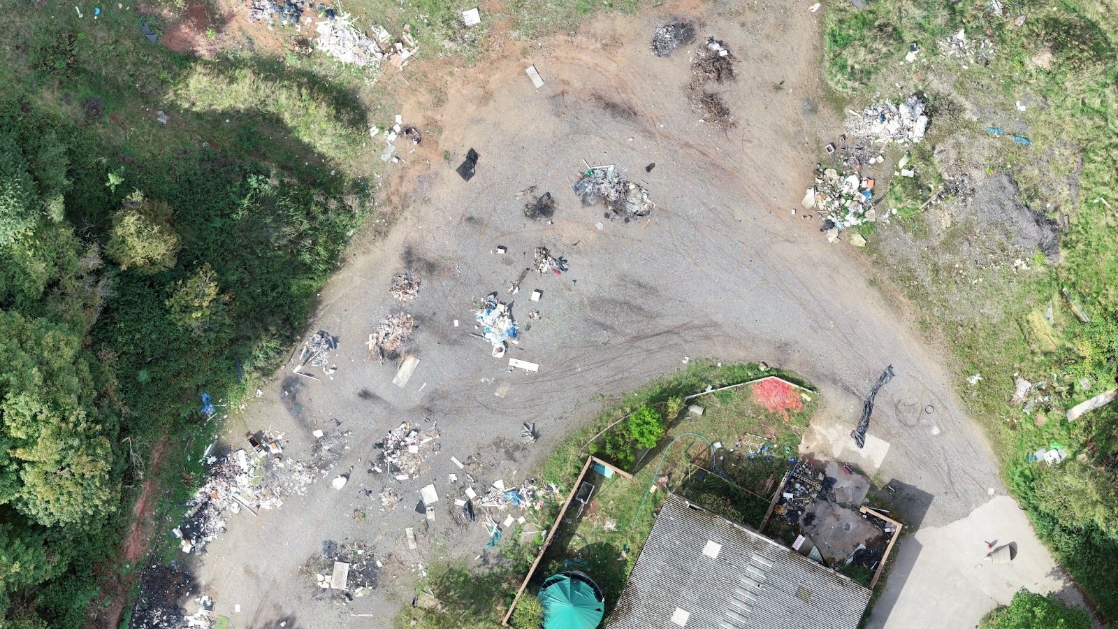
Photogrammetry is crucial for environmental monitoring, studying land changes, pest infestations, invasive plant growth, wildfire risks, and rubbish tipping. Drones provide first responders with critical data for developing rescue strategies and reducing risks in disaster scenarios.
Conclusion
Drone photogrammetry services offer a revolutionary approach to data collection, providing unmatched precision, efficiency, and safety across various industries. Whether it's for construction, agriculture, environmental monitoring, or infrastructure inspection, the use of drone photogrammetry can significantly enhance operational effectiveness. By leveraging these advanced services, organisations can achieve superior results, ensuring accuracy, safety, and sustainability in their operations.